

Statewide weather report and information produced by Penn State's Weather Communications Group faculty and students.
00:00 - >> From the band Family Studios in the
00:03 - Department of Meteorology and Atmospheric Science
00:07 - at Penn State, this is Weatherworld.
00:17 - >> Good evening, Pennsylvania, and welcome
00:21 - to Weatherworld on this Friday night, October 30th, 2026.
00:27 - I'm Carl Schneider, thank you so much for
00:29 - joining us on this day that was bright and breezy
00:32 - classic post frontal setup here in Central Pennsylvania.
00:35 - Of the details on the short range forecast
00:36 - through the Halloween weekend, which I'll have to admit, is not very scary.
00:40 - We'll also have the extended forecast where we might see a chance of rain and Johnny's
00:44 - will have week two trends, but we'll start by
00:46 - jumping into the forecast with a look at the
00:48 - low temperatures across Pennsylvania this
00:50 - morning, and I really wanted to point this out
00:52 - because many folks started the day in the
00:55 - '50s, which in terms of central and northern
00:57 - PA is near our average highs for this time of year.
01:00 - This is because we had warm infection ahead of
01:01 - a cold front that moved through in the overnight
01:03 - hours, and we're post frontal today, and
01:05 - that's the reason it's been bright and breezy across most of the Commonwealth.
01:09 - The night camera view shows a mix of clouds and
01:12 - sun across northern Pennsylvania, and elsewhere
01:14 - it was just mainly a clear day with a few serious clouds drifting through.
01:18 - The low clouds are breaking up and are going to be out of the picture for tonight.
01:21 - We'll have to deal with the high clouds here in the short range forecast, and those
01:24 - will be increasing in coverage as we go through the weekend.
01:28 - So the radar in satellite, obviously nothing on the radar today, it was a dry day.
01:32 - You can see that low cloud deck early in the
01:33 - day across the northern tier that is since dissipated, and then a few high serious
01:37 - drifted through parts of northern and central Pennsylvania.
01:40 - Through the afternoon hours, I think it's
01:41 - going to be a mostly clear night for all of us.
01:44 - And temperatures are very interesting today
01:46 - because across northern Pennsylvania, we really
01:47 - didn't go much of anywhere, it's even dropped in the
01:50 - upper 40s in Bradford, assigned things to come tonight.
01:53 - But southeast of the mountains where we've had
01:54 - the downsloping flow, that's allowed temperatures
01:56 - to reach or even exceed 70 in some locations.
01:59 - We're not going to be this warm this weekend,
02:01 - but generally a few degrees above average in the 50s and 60s for most.
02:06 - Another big story today where the wind speeds sustained winds.
02:09 - It's a very breezy day behind this front,
02:11 - very common place in the cold season here in
02:13 - central PA, and this is something that's been absent recently.
02:16 - So the good news is if you don't like wind,
02:17 - these values are going to be diminishing very
02:19 - quickly after dark, and we're going to have
02:21 - little with any wind to deal with through the weekend.
02:25 - broader view shows that we're kind of high and dry here in the mid-Atlantic.
02:28 - We have to expand to the bonus view to really see anything interesting.
02:32 - Massive rain and some embedded downpours
02:34 - associated with the remnants of tropical storm
02:36 - vents, bringing beneficial rains to the southern plains.
02:39 - But thanks to a high pressure drifting from the Great Lakes, and that's going to camp
02:42 - itself overhead, it's going to push all of this activity to the south.
02:46 - The only impact we're going to have over the
02:48 - weekend due to this is the cloud cover specifically
02:51 - in the high variety in altitude, and I should
02:54 - say here we're looking to infrared satellite
02:56 - and the brighter colors are corresponding to
02:58 - the colder cloud tops telling us those are
03:00 - high in altitude, and those are kind of be streaming off towards our region, and we'll
03:04 - increase in coverage through the day tomorrow and especially into Sunday.
03:09 - But the very warm air mass is going to stay to the south, and we're just going to be
03:13 - dealing with slightly above average temperatures
03:15 - with kind of west, north, west flow here through the weekend.
03:18 - So the evening surface map shows that high
03:20 - pressure taking control across the Great Lakes.
03:22 - It'll slide here to the east overnight, so I think most of us stay clear.
03:26 - Few high clouds drifting by, but the story of the cloud cover is going to be moving
03:29 - into tomorrow, where cloud cover will increase
03:32 - in western Pennsylvania through the afternoon hours.
03:35 - Notice the high pressure is sitting right over
03:37 - Pennsylvania, so very little if any in the
03:39 - way of wind tomorrow, and you'll see the center of this high
03:42 - pressure doesn't really go anywhere as we go towards Sunday either.
03:46 - But the cloud cover will likely increase in coverage through the day's Sunday, so we'll
03:50 - become mostly cloudy, but that won't make it feel cold or chilly.
03:53 - We'll still be reaching the low to mid 60s for most of us for daytime highs on Sunday.
03:58 - So tonight, the nighttime chill returns frost
04:00 - and freeze risk once again for a north central
04:03 - PA where some locations could even drop into
04:05 - the upper 20s elsewhere, just a light breeze
04:07 - that will gradually diminish after midnight
04:10 - with lows hanging into the mid 30s to lower 40s in southeastern Pennsylvania.
04:14 - You'll see plenty of stars early in the
04:16 - night before the moon rises around the middle of the night.
04:19 - Going into Saturday, Halloween, bright, but not as breezy as it was today.
04:23 - Little if any wind, mostly sunny across most
04:26 - of the Commonwealth with clouds increasing late in the day in the west.
04:30 - Highs very comfortable mid 50s north, lower
04:32 - 60s southeast, and then moving into Sunday much
04:35 - of the same in terms of the temperature department, taking out maybe a little bit.
04:39 - The clock's falling back on Sunday morning,
04:41 - and we'll have a very nice afternoon, a little
04:44 - bit warmer along the I-79 corridor in the mid 60s.
04:47 - So we're back with the extended forecast up next.
05:11 - Part two of our Friday forecast frenzy is the
05:15 - extended forecast, which will take us through
05:19 - the first full week of November, and we
05:21 - finally have some rain to talk about, though I
05:23 - think we'll have to wait until the second half
05:25 - of the week before those rain chances really materialize.
05:28 - Before we get there, I wanted to remind folks that we do have a contest underway.
05:31 - Our annual snowflake contest invites you,
05:34 - the viewer at home, to be the forecaster, and
05:36 - guess the dates of the first one inch snow of
05:38 - the season, at all the stations listed here on the map.
05:41 - We've got some great prizes at stake, including
05:44 - our snowflake, wooden ornaments, an umbrella, and more.
05:47 - You can go to our website weatherworld.psu.
05:50 - edu and click on the link on the home page.
05:52 - That forecast must be submitted by tomorrow night,
05:54 - so make sure you get those in if you haven't already.
05:57 - All right.
05:58 - Turning back to the extended forecast, we'll
06:00 - begin with a look at the water vapor satellite imagery.
06:02 - This is our way to get a sense of the steering
06:04 - winds aloft, and we've been predominantly
06:06 - seeing high pressure in control and kind of a lack of moisture with any boundaries that
06:10 - have crossed recently, only spitting out just
06:13 - about 200 of an inch of rain in eerie last night.
06:16 - Sprinkles elsewhere, so we've had a prolonged
06:18 - dry stretch, and that does look to continue
06:20 - as we begin the week ahead with high pressure, backing control at the surface.
06:24 - I think that will slowly be slipping eastward.
06:27 - I think this pattern, by the way, is still favors
06:29 - mild conditions, mild nights, patchy valley
06:31 - fog likely, and temperatures during the daytime, mainly in the 60s.
06:35 - We should be in the 50s this time of year.
06:37 - We're drying on Monday and Tuesday.
06:39 - I don't think we'll be quite as sunny as
06:40 - we've had in recent weeks, but I think we will see at least a mix of clouds and sun
06:45 - watching this piece of energy off the coast.
06:47 - That will be a player potentially going into the second
06:50 - half of the week, along with this trough here in the plains.
06:54 - These two will bring us our rain chances by the
06:56 - time we get to, especially Thursday and Friday.
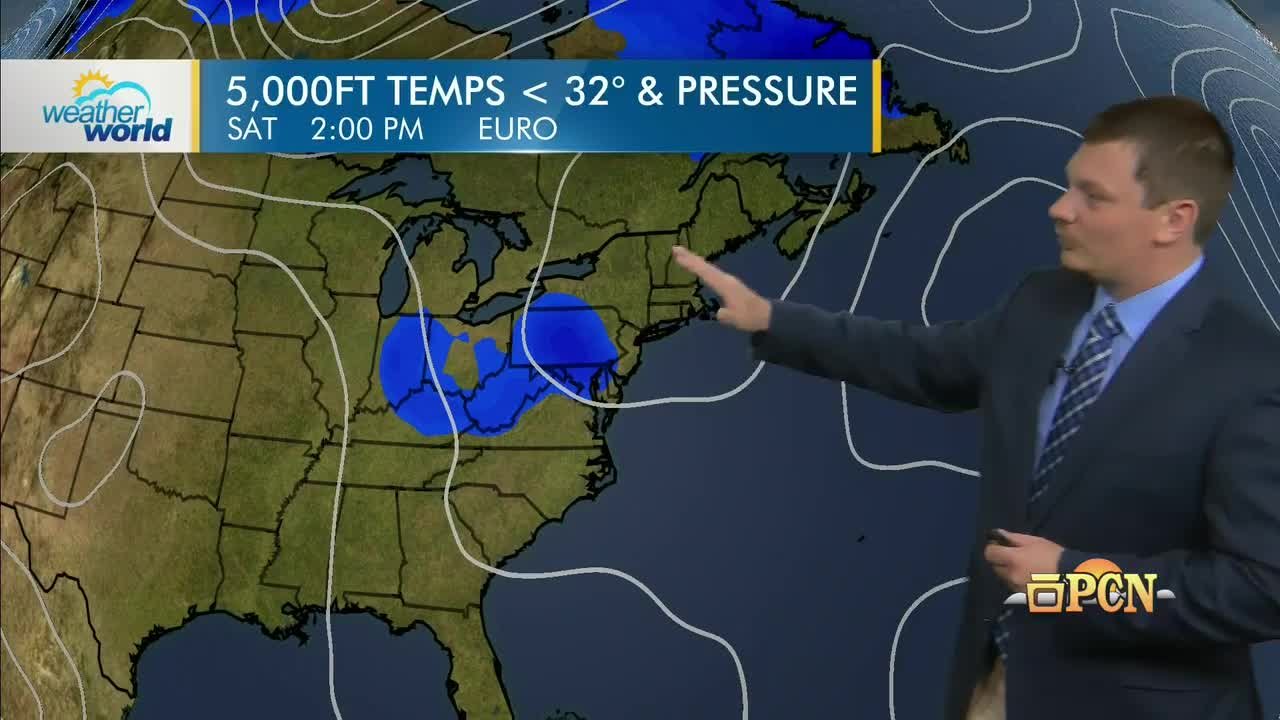
06:59 - Here's Wednesday on the European model, still
07:01 - seeing that coastal low and this approaching trough.
07:03 - We'll see a cold front slicing through the Midwest.
07:06 - A lot of the energy with that off to the
07:07 - north, but we will see kind of a secondary area
07:10 - of low pressure forming in the Mississippi River Valley.
07:13 - And if those two energies consolidate, we could
07:15 - be talking about some heavier precipitation,
07:17 - especially in eastern Pennsylvania, as we go into Thursday by Friday.
07:22 - That storm system kind of cuts off and we'll
07:24 - be looking at rain showers wrapping around as we conclude the work week.
07:28 - A different perspective here on the precipitation tracker.
07:30 - I mentioned high pressure remains in control
07:32 - for Monday, Tuesday and most of Wednesday.
07:35 - We are watching that boundary still situated
07:37 - off to our west with a kind of a warm front
07:39 - that will be stationed farther off to the north.
07:42 - Area of low pressure off the coast may eventually inject some more moisture.
07:45 - There's more uncertainty with just how this coastal low could interact.
07:49 - The European model does spit out some steadier
07:52 - precipitation arriving here on Thursday.
07:54 - Other models, kind of a slower arrival of that.
07:56 - But no matter which way you shake it, our rain
07:59 - chances finally increase Thursday and Friday of next week.
08:02 - The uncertainty, I think, will be just how widespread the heavy rain chance will be as
08:07 - we go into the end of the week also becomes breezy, but
08:09 - no model solutions pull any cool air in here next week.
08:14 - So on Monday, we'll see clouds and sunshine
08:17 - temperatures in the 60s, mild nights, many places
08:19 - staying in the 40s and 50s, high clouds for
08:21 - election day, but otherwise, no weather worries.
08:25 - So be sure to get out and make a plan to vote.
08:26 - A mix of clouds and sun on Wednesday temperatures remain above average.
08:30 - And then I think we'll see mostly cloudy skies Thursday and Friday.
08:33 - And finally, some rain could be steady and maybe a soaking rain.
08:37 - Some models even showing an inch of rain by the end of the week.
08:40 - Some of that could also be heavy in the east.
08:49 - That doesn't for the extended forecast, John goes deeper in November, up next.
08:57 - Week 2 trends is our once a week opportunity,
09:00 - always on Fridays, to look beyond the extended
09:03 - forecast into the period eight to 14 days out.
09:06 - So this will begin next Saturday and extend through two weeks from today.
09:12 - We don't give you too many specifics, largely
09:14 - generalities, and I think what I can say about
09:16 - this period is it seems unlikely that we would see much in the way of unusual chill.
09:22 - And although the pattern will be a little more active than it has been over the last
09:25 - 10 days or so, I see the dryness dominating the wetness during that week to period.
09:32 - Here are the average highs and lows right in the middle of the week to period.
09:37 - These numbers are two to three degrees lower
09:39 - than they were last week when they showed them to you.
09:42 - And keep these numbers in mind because I
09:43 - think during the week two period, temperatures
09:45 - will largely be at or above these climatological averages.
09:50 - Notice that by this time, even at temperature
09:53 - in the mid upper 50s would be above average in central Pennsylvania.
09:57 - We're going to show you the solutions from
09:59 - about 30 different computer model simulations,
10:02 - each starting with slightly different starting values.
10:05 - These pressure lines up around 20,000 feet
10:07 - allow us to evaluate the upper air winds, which
10:11 - tend to follow these lines from west to east,
10:13 - also where these lines dip to the southeast troughs tend to bring in clement weather
10:17 - and cooler than average weather, at least at
10:19 - high altitudes, and where they bulged to the
10:21 - north these ridges, and there's a distinct
10:24 - one in western Canada, represent relatively warm
10:26 - air aloft and generally sinking air and dry weather.
10:30 - As we go through time, this is next Wednesday.
10:33 - The individual color lines are separating
10:34 - because that's a sign of the growing uncertainty.
10:36 - I want to draw your attention to the blue lines.
10:39 - This time of year, the blue lines really represent
10:42 - unusual chill, and notice they are bottled up in Canada.
10:45 - And even at the beginning of my period, next
10:49 - Saturday, those blue lines are bottled up in
10:52 - Canada, which means that there's really no
10:54 - unusual chill around to funnel into the lower 48 states.
10:58 - So even though our wind patterns will begin
11:01 - to shift to more of a north-west-early flow, there's no cold air in Canada.
11:06 - This is now averaging all of the model
11:09 - solutions, and these amber and orange colors here
11:12 - represent temperatures at high altitudes above average.
11:16 - So even in a northwest flow, we really can't get any kind of chill in here.
11:21 - So I'm going to advertise during the week two period, a number of days above average
11:26 - and none below average, despite the presence
11:29 - of this bluish color here, which indicates slightly cooler air aloft.
11:34 - This northwest flow is also a generally dry pattern.
11:37 - And so although I think there will be
11:39 - opportunities, more opportunities than we have had
11:41 - lately to get precipitation, I don't have a
11:43 - high degree of confidence to put any of those opportunities on our week two charts.
11:49 - So taking a look at the precipitation line,
11:52 - I do have some confidence of another extended
11:55 - period of dry weather, largely at the beginning of the week two period.
11:59 - I'm not saying it's not going to rain, but I don't have
12:01 - high confidence in when that precipitation would occur.
12:05 - On the temperature line, you see three mild days.
12:07 - It won't be a consistently mild pattern, but unseasonable cold is unlikely.
12:12 - It's even possible that these three days here
12:15 - could end up warmer than average as well.
12:17 - That's it for week two trends.
12:19 - We'll be back in a moment with more.
12:28 - Some comfortable weather is in store for our
12:32 - Halloween weekend, beginning with this evening.
12:36 - The winds will diminish, so it'll be comfortable,
12:38 - but then temperatures will quickly tumble
12:40 - as we go through the overnight hours, possibly
12:42 - below freezing a north central PA mid 30s to low 40s elsewhere.
12:46 - Not much in the way of cloud cover and by midnight
12:48 - or so, not much in the way of wind either.
12:51 - Looking into Saturday, bright, but not as
12:53 - breezy as it was today, high temperatures, very
12:55 - comfortable mid 50s north, low 60s southeast,
12:58 - light winds, so that won't be an issue.
13:01 - We have some high clouds moving in from the
13:02 - west, which will increase cloud cover in western Pennsylvania by the afternoon.
13:06 - Those will spread eastward overnight, Saturday
13:08 - night, I should say, into Sunday as we fall back.
13:12 - It'll become mostly cloudy across much of
13:13 - central and western Pennsylvania throughout the day on Sunday.
13:16 - More of a filtered sunshine scenario in eastern
13:18 - Pennsylvania, but the cloud cover shouldn't
13:20 - limit high temperatures still very mild for this
13:23 - time of year, mid 60s along the I-79 corridor,
13:26 - low 60s in central PA and low 60s in the
13:29 - southeast as well, so very comfortable to end the weekend.
13:33 - Thank you all so much for joining us tonight.
13:35 - Be sure to join us again Monday for the weather world winter outlook.
13:39 - We'll see you then.
13:50 - Bye.
[CC] Weather World 11/04/26

Emporium Borough, Exploring Pennsylvania Boroughs

What Does America250 Mean To You?: Weather World's Jon Nese